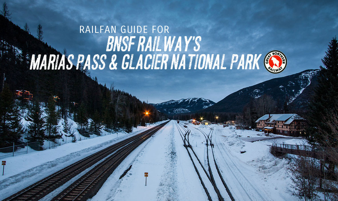
Glacier Park Tour
Whitefish to East Glacier, MT
A detailed, self-guided tour
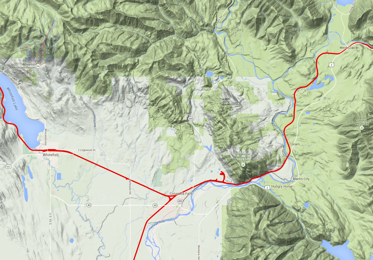
INTRODUCTION: There are many mountain railroads in America, but few are as storied and famous as James J. Hill’s route between Seattle/Tacoma and the plains of Montana. This tour describes the railfan locations in one famous part of the route. You’ll travel from the tourist town of Whitefish, thru the valley traveled by the Middle Fork of the Flathead River, up and over the Continental Divide at Marias Pass, and on to the seasonal vacation town of East Glacier. This is the Burlington Northern Santa Fe’s northern route, but virtually everyone refers to it as the Great Northern.
CONTENTS AND NAVIGATION:
![]() ABOUT THIS TOUR
ABOUT THIS TOUR
![]() OTHER TOURS
OTHER TOURS
![]() CONTRIBUTORS
CONTRIBUTORS
![]() A REQUEST FOR HELP
A REQUEST FOR HELP
![]() SITE LISTING
SITE LISTING
![]() SUGGESTED ITINERARY
SUGGESTED ITINERARY
![]() THE TOUR
THE TOUR
![]() SUPPLEMENTAL AND BACK-UP DATA
SUPPLEMENTAL AND BACK-UP DATA
For information concerning the other Frograil tours which have been put together, go to the Tour Guide, which is here. You’ll also find a recommended packing list and plenty of good advice designed to save you both time and grief.
Chris Denbow created the train gifs used throughout Frograil. When your not-so-humble Webmaster gets bored with text, he tends to stick Chris’s gifs in — no rhyme or reason, it’s just what I enjoy. Look for them anywhere.
Tony Hill, Webmaster and text provider
A REQUEST FOR HELP: If you’d like to contribute to this, or any other tour, please contact me at tohill@hotmail.com, and let me know what you’d like to do. We’ll work together: You supply the data/info, and I’ll do the HTML stuff and upload it. You’ll get a chance to review the fruits of your efforts before the general public sees the finished product, so you can let me have your corrections, additions and changes.
SUGGESTED ITINERARY. Unlike most of the tours I’ve done, this one is much more than just a jaunt along a railroad. The Glacier National Park area is an world-class tourist area, and is far from any major population centers. You probably don’t go all the way to Glacier just to watch some trains. Certainly, you can do so, but to not spend some time in the Park and National Forest would be a terrible thing. Also, the tour itself is a little difficult to do thoroughly the first time. For these reasons, I’ve put together my suggestion for a vacation which will include the railroad between Whitefish, West Glacier and East Glacier in both directions, and will also include the Going-to-the-Sun Road and Montana state highway MT-49, which is quite a trip by itself.
In August of 2001, my wife and I spent three full days in the area, and this suggested itinerary is based on our experiences up there. Modifications have been made to improve on our original tour. I am assuming the tour is to be taken in the summer. For you skiers, I can’t help you much, because I don’t like cold weather, and know nothing of the area in winter. Obviously, major changes would have to be made: Sitting at the top of Marias Pass with the wind blowing 60 mph and the temperature about -35º is not my idea of a neat railfan experience!
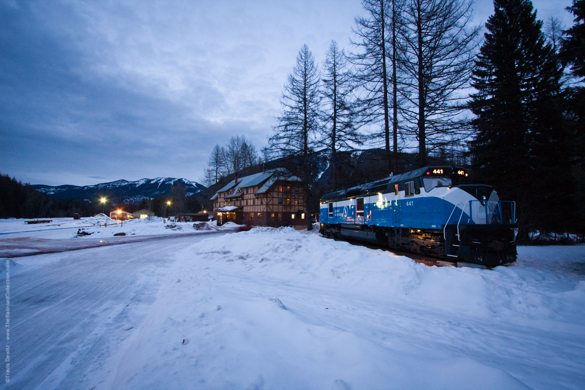
Lodging. You can stay in Whitefish, Kalispell, West Glacier, or East Glacier, but all of these have the disadvantage of being on the edge of the area. There is only one place to stay in the middle of the railroad area, and it’s the best place in the mountains: The Izaak Walton Inn in Essex. This is the only flag stop on the Empire Builder. Inn personal pick you up at the train, as there is no station, per se. Rooms are just over $100 per night, and if you’ve got a family, you can rent one of 4 cabeese which are set up as guest suites. The Inn has a restaurant and full-service bar and game room. It also has a nice gift shop.
The front yard has a couple of baggage carts with flowers on them, but the big attraction is the BNSF main line about 150′ from the front door of the Inn. There is a walkway over the tracks to the cabeese, and good photos can be made from it in the morning. The Inn is about 1/2 mile from US-2, which is your main route for almost the entire tour.
Camping. There are campgrounds all over the place, as you can imagine, including some in the vicinity of Essex. Depending on your hook-up requirements, there are sure to be plenty of sites just right for your pup tent or monster motor home.
1st Day. Assuming you’re at the Izaak Walton Inn, head west on US-2. Do the railfan tour thru West Glacier, and then head up to Glacier National Park and do the Going-to-the-Sun Road. The road is only about 50 miles, but you should allow for several hours, as you’ll want to take advantage of the many scenic attractions along the way. Also, marvelous hiking is available, and you can get away from the tourists real fast on many of the trails. When you reach St Mary, the eastern gateway to the Park, take US-89 south towards Browning. When you get to the intersection with MT-49, take it south to re-join US-2 in East Glacier. MT-49 is a road you cannot hurry on, as it is mountainous and some of the views are breathtaking. You don’t want to miss either the curves or the views, believe me. Follow the railfan tour in reverse from East Glacier to Essex. You’ve now done the tour from east to west from East Glacier to West Glacier. I’d suggest following the railfan tour rather loosely, as you really are mostly getting a feel for the area and the railroad.
2nd Day. Go to Whitefish and play tourist. Eat at the good Italian Restaurant (Remington’s?), railfan, have a Black Star Amber at the Great Northern Brewery, and just relax in a very nice town. On your way back, railfan in earnest on the way east between Whitefish and Essex, especially the area from West Glacier to Essex. Follow the tour closely.
3rd Day. You need to railfan the Essex to East Glacier section closely, but you’re better off doing it in the late morning to mid-afternoon, so I’d suggest you explore the Essex area in the early morning: Essex Vista, Goat Lick, East Java, and the Essex crossovers. Then, head east to closely railfan all the way to East Glacier. You’ll want to spend some time at Marias Pass, especially, so don’t be in a hurry. When you get to East Glacier, you’ll have fanned the entire Whitefish – East Glacier route in both directions.
SUPPLEMENTAL AND BACK-UP DATA.
First Tour? If you’ve never taken a Frograil tour before, you are strongly urged to visit the Tour Guide and study it. You’ll almost certainly save yourself some time and grief.
The Railroad. This is BNSF’s main line between Seattle/Tacoma and Minneapolis. It is a single track main, with many passing sidings. They are passing sidings only, usually fairly short, i.e., seldom more than 2 miles. As a result, running meets are not common . Whitefish is the major yard in the area, and is a crew change point. Trains can be almost anything, but are often quite long, especially the stackers. Intermodal predominates, but manifest freights and grain trains are common. I saw one Powder River coal train with 2 SD70MAC’s on the front, and an SD70MAC and a big GE DC unit on the rear. Overall, most power is relatively new GE units, in both the newest orange and stripes scheme and the ATSF gray and red. Three helper sets are stationed at Essex (all SD40-2’s), but the coming of distributed power puts their future in doubt. Expect about 1 train per hour, but as is the case everywhere else, they can come in bunches after a long lull.
Mapwork: Much of the tour is not easy if you have no detailed map for back country roads. I definitely recommend you get a DeLorme Atlas & Gazetteer, study it before your trip, and copy pertinent pages for your field work. You can usually get substantial discounts on DeLorme atlases thru the Frograil Railfan Store, which is here.
| WEBMASTER’S NOTE: I do not recommend or condone walking along the tracks, as this means trespassing and exposing yourself to danger. You will have to be creative, in some instances, to avoid trespassing while getting to the detailed locations included herein, but you will either have to be creative or not visit those sites. At no point in this tour guide, or any other tour which is part of Frograil, is it recommended that you trespass or expose yourself to danger. If you are a fool and have a leg cut off (or worse), don’t come crying to me: You have been warned. Trains are big, powerful, and often surprisingly quiet. Don’t end up being a statistic. |
I suggest you print this entire tour out and follow it on maps before beginning your actual tour.
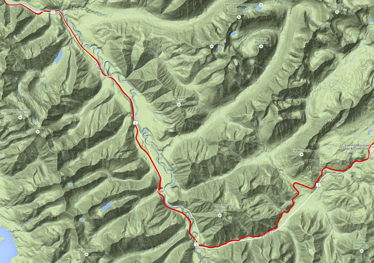
Whitefish to East Glacier, Montana
Railfan sites:
| Alphabetical | Sequential Order: |
| Sequence | West to East |
| —————————————— | —————————————— |
| Belton — West | Whitefish |
| Bison — West | Columbia Falls |
| Columbia Falls | Coram |
| Coram | Belton — West |
| East Glacier — Midvale Trestle | West Glacier |
| East Glacier — Station Area | West Glacier — Tunnels |
| Essex — Crossovers | Nyack MP 1188.0 |
| Essex — Izaak Walton Inn | Red Eagle |
| Essex — Java East | Paola |
| Essex — Vistas | Paola — Vista |
| Marias Pass | Essex — Crossovers MP 1170.6 |
| Marias Pass — East | Essex — Izaak Walton Inn |
| Nyack | Essex — Vistas |
| Paola | Essex — Java East |
| Paola — Vista | Marias Pass MP 1149.8 |
| Red Eagle | Marias Pass — East |
| West Glacier | Bison — West |
| West Glacier — Tunnels | East Glacier — Midvale Trestle |
| Whitefish | East Glacier — Station Area |
The Tour
Whitefish. We start our tour at the beautiful, impressive, and distinct, Great Northern station. From US-93 in the center of town, go north on Central Avenue or Baker Avenue to the yard and station. The first two tracks are main tracks, and the yard tracks are north of these. Whitefish is a crew change point, so virtually all trains stop just west of the depot. Be careful not to park in BNSF parking areas. You cannot pass the fence into the yard, but there is a small break/entry in this fence next to the yard office. You can stand on the top step and get surprisingly good roster shots, and not trespass while doing so.
For better railfanning, a visit to the station is a must. It’s open 24/7, and is a very interesting structure inside and out. There are public restrooms available. Outside, on the east side of the depot, is a grassy area with benches and a picnic table. This is the best place in town to see the action, as it’s quiet and surprisingly private because of the big trees behind you. Immediately south of this point is the public library, which is quite new and very nice. There are Internet-ready computers, restrooms, and magazines to keep you shielded from the elements in poor weather. Another good spot is the Great Northern Brewery, home of Black Star Amber and other excellent local brews. Actually, the whole downtown area is quite nice, and is the home of restaurants and touristy-type shopping.
BNSF Marias Pass – Click to Enlarge
Before proceeding, there are a couple of important considerations for all railfans:
1. During this tour, you will be at a high elevation in the far north of our country. While everyone understands that the winters are brutal here, many visitors seriously underestimate the potentially severe weather of spring and fall. You can enjoy a nice day of 65º and then get 2 feet of snow overnight. You must have proper clothing, water, food, etc., and you must be prepared to drive and exist under difficult conditions.
2. For much of this tour, especially between West Glacier and Marias Pass, you will be in bear country, and you’ll be visiting places frequented by them. Be aware of bear avoidance methods, and if it makes you feel more comfortable, get a bear spray canister.
3. Unlike many railfan tours, the twists, turns, ups and downs of this drive present you with an odd phenomenon. When you drive this tour west to east, you’ll think “Aha, I’ve railfanned this line.” However, if you then drive back east to west, you’ll think you’re fanning an entirely different line. Things look very different, and you’ll see railfan locations which were completely invisible from the other direction. For this reason, going in both directions, especially between West Glacier and Marias Pass is highly recommended. I’ve included a Suggested Itinerary for you, which will allow you to view the route skirting Glacier National Park in each direction, and includes a drive over the Going-to-the-Sun Road in the park.
4. Also unlike many railfan tours, noise from highways, planes, etc will not be a factor on this tour. However, when you’re close to the rivers and streams you’ll encounter along the way, there is a surprising amount of ambient noise. Trains can be on top of you in a hurry. Stay alert, and stay away from the tracks at all times.
5. Because of the potential hazards inherent in this tour (weather, rough terrain, bears) you are strongly advised to fan with at least one male friend at all times.
Columbia Falls. Between Whitefish and West Glacier, the railroad and highways are on opposite sides of some rather large rivers, so you’ll have to catch up to trackside in the small towns along the way. The first is Columbia Falls. Depart Whitefish south on US-93, and go east on MT-40 towards West Glacier at the intersection south of town. MT-40 will run into US-2, which will be your route all the way to East Glacier. As you come into Columbia Falls, you’ll cross a single track which is the branch down to Kalispell. In the center of town, go north on Nucleus Street and go all the way to the tracks. The near tracks are main tracks and the northern tracks are storage/yard tracks, primarily for the Plum Creek Timber Company and for the branch to Kalispell.
Plum Creek runs a very large log and lumber operation, and seems to occupy about 1/4 of the entire town. The junction of the main and branch lines is buried within the mill and is inaccessible. At the tracks where Nucleus Street ends is a rather incredible 2-truck shay(?) locomotive. There is no identifying plaque, so I know neither the type, builder nor history of the unit. You ferroequinologists will not want to miss it.
Coram, MT
Coram. Again, the railroad is inaccessible for most of the distance between Columbia Falls and Coram, so just follow US-2 into Coram. (Note that the tracks do not go thru the Hungry Horse area. Hungry Horse is the site of a large dam and lake, and is a very popular summer vacation area.) As US-2 reaches the village of Coram, there is a large Exxon station on the north side of the road. Turn left to go behind the station to get to the tracks. There is lots of room for parking, and photos are good because you’re on the south side of the tracks. This is the end of a passing siding, and double track begins to the east.
Belton — West. As you come into the area of West Glacier, you’ll see lodges, helicopter rides, RV parks, etc. If you’re alert, you’ll also see the Belton Stage Road going north (left). Take it, and as it bends sharply to the west, take a right and go down to the tracks. The photo area from the south is pretty tight, but from the north you’ve go pretty good viewing. If you’re staying in the West Glacier area, this is a quick and easy place to get to, and it offers peace and quiet away from the tourists. This controlled point is the end of double track to the east.
Continuing east from Belton — West, you’ll come to an intersection with a road going under the tracks to the north. This is the entrance to Glacier National Park and the Going-to-the-Sun Road. More information is included on this site in the Suggested Itinerary. There is life support in this area, and you’ll want to stock up on film, grub, gas, etc, before going further east. Since we’re now in the Glacier National Park area, per se, this is a good time to consider something else. This entire area is a tourist Mecca during the brief summer period of June – August. If you’re planning on coming here, make certain that you’ve got your reservations for rail, air, motel/campground far in advance. We took the Empire Builder from Chicago on August 1, and it was booked solid. The same for the Izaak Walton Inn and the flight back from Kalispell to Chicago. We made reservations in January. If I were you, I’d make them even earlier.
West Glacier. On the northeast quadrant of the intersection leading into the Park, the Great Northern’s station provides a good railfan site. Note that the railroad calls this location Belton, and the station is identified as such. I don’t know when the city’s citizens changed its name to West Glacier, but that’s how it’s identified on all road maps. The station is a year-round Amtrak stop, and also houses the Glacier Natural History Association, which has information, displays and a bookstore. The station platform is too tight for photos, but there is plenty of room southeast of it for good pix. Be aware that freights go thru here at a 30-40 mph clip, so be alert and stay back from the tracks.
West Glacier, MT
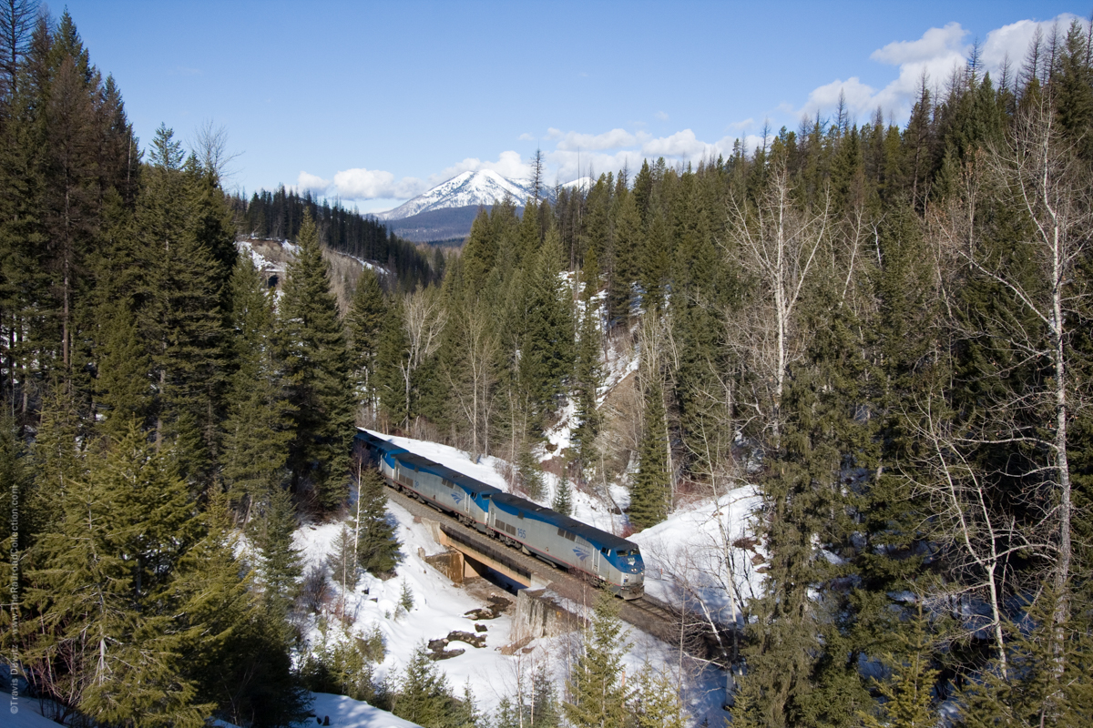
West Glacier — Tunnels. Contrary to what we’ve experienced so far, the railroad will now be close to US-2 from here all the way to East Glacier, with only relatively short bursts of inaccessibility. Even while inaccessible, we’ll see locations for some awesome photos. This will be an area with no convenient road signs pointing out railfan locations, so you need to be alert. Have the best maps you can get, and take it easy on the speed. More than one railfan represents more than one set of eyes, so here’s another reason to fan with friends. You’ll be following the Middle Fork of the Flathead River all the way to the east of Essex, and both the river and railroad will often be far below the road. There are a few places where the railroad goes under you via tunnels, and you need to be alert to those instances. NOTE WELL: Even though US-2 is a 2-lane highway, the speed limit varies between 55-70 mph, and the locals drive fast. Keep an eye on the rear view mirror, and use one of the many pull-offs to let faster traffic go by.
From West Glacier to East Glacier, the geography of the area forces the road, railroad and waterways into a large “V” shaped route. About half of it runs northwest – southeast between West Glacier and just south of Essex, where it changes abruptly to a southwest – northeast route all the way to East Glacier. As you get to the next few locations, the combination of diagonal directions, big mountains, steep access roads and canyons, and the ever-present evergreens, makes getting a good photograph under optimal lighting conditions challenging, to say the least. The more time you have to study an area, the better your results will be.
There are at least 2 dirt roads leading down to the tracks. The first is fairly obvious. There is no road sign marking it, and you’ll know that the railroad is straight down on your left (north). Go down this road, or better yet, park and walk down it, and you’ll be in an area roughly between 2 tunnels. Remember , you’ll be close to the Middle Fork of the Flathead River, so it’ll be noisy here — you need to stay well back from the tracks, and don’t even think of poking around the tunnels or their openings.
Traveling further east on US-2, as you crest a portion of the mountain you’ll been going up, you’ll see (but only if you’re very definitely looking for it) the top of another dirt road going down to the tracks. The actual road is invisible, because it drops off quite sharply. There is an iron post on each side of this road for a chain, but no such chain has been present for what appears to be many years. If the weather is poor (wet, freezing, snow, etc., you’re advised to park at the top and walk down. I drove down and back up in a rented Plymouth Neon with no trouble, but conditions were ideal. There is a large area back from the tracks for parking and fanning — you don’t need to get any closer to the tracks. The tunnel mouth is MP 1193.
If you suddenly find the railroad on your right, you’ve gone past the last location, and need to do a U-turn and go back west. You’ll see a beautiful vista with the river, mountains, and railroad going northwest. You’ll also see a very obvious, well-maintained gravel road leading down to the area of the tracks. As mentioned in the previous paragraph, this is the invisible road you’re looking for. Your travails are not over, however, because the turn from the east is too sharp to negotiate, so you need to do yet another U-turn to get onto the road by coming from the west. This is an excellent late morning to mid afternoon location.
BNSF Marias Pass – Click to Enlarge
Nyack. Continuing to the southeast, the road will descend to track level, and you need to be alert for an unmarked, gravel road heading towards the tracks. The west end of a passing siding is here. Note that the virtual 45º angle of the railroad makes figuring out timetable west vs. east somewhat confusing. A compass and good map are helpful all along this tour. Note that mapQuest has Nyack erroneously located. They show the location being the location of Red Eagle, our next stop.
Viewing here is a little tight, and is better at Red Eagle. You are at MP 1188.
Red Eagle. About 2 1/2 miles past Nyack, you’ll see an unmarked gravel road heading towards the tracks. There is probably a road sign showing a road heading towards the tracks, as well as a sign for river access. This is identified as Silver Tip Road by mapQuest, and again, the place is erroneously marked as “Nyack”, but it is most definitely Red Eagle, and the end of the passing siding which started at Nyack.
Viewing is better here than at Nyack, and you should get some good pix.
Paola. Just past Red Eagle, the railroad crosses to the other side of US-2, only to reverse itself a few miles later. You’ll see a sign to Stanton Road/TR-146, and there’s a short driveway to the tracks opposite Stanton Road. This is a big, open area with excellent viewing from both sides of the tracks. You are still decidedly NW-SE here, so most trains should be in good light except for very early morning. This is a lawn chair and cooler location. Get them out and relax and let the trains come to you. This is an excellent railfan location.
Amtrak – Paola, MT
Paola — Vista. You’ll now go up and over the tracks, but the tracks themselves are hard to see. Indeed, a stunning vista is invisible when coming from the west. You’ll see a “Paola Bed and Breakfast” blue sign, and if you come to US-2’s MP 173, you’ve gone too far. Park and walk (carefully) back towards the crest of the hill, and to the northwest you’ll see the tracks snaking along the valley, finally disappearing into the tunnel just below you and to your right. This is really quite a sight, and has to be seen to be appreciated. Be careful of the traffic on US-2 here, as there isn’t much room on the shoulder.
Essex — Crossovers. As you near Essex on US-2, you’ll see a sign pointing to Dickey Creek and Essex Creek roads. Turn right and go over the tracks and park to the right. In the afternoon, when the sun works against you at the Izaak Walton Inn, this is the place to be. It’s a short, 30-minute walk from the Inn, and has quite a few less people around. There are roads on both sides of the tracks, so morning and afternoon shots are both possible. The big bugaboos here are the coniferous trees and mountains, which eliminate early and late photos from any direction. The Essex defect detector is immediately west of Dickey Creek Road. About 100 yards east of this road is the Essex crossover CPt at MP 1170.6, and the western lead to the small yard at Essex.
Izaak Walton Inn – Essex, MT
Essex — Izaak Walton Inn. Continuing east on US-2, you’ll see a sign to the Izaak Walton Inn. This is your home base for the Suggested Itinerary, and is a terrific railfan asset. Open year round, the Inn is a former Great Northern crew hotel which has been turned into a delightful year-round resort location. It is well known for its 30+ miles of groomed cross country ski trails, and downhill skiing is nearby. Summers bring out hikers, bicyclists, and nature lovers. Railfans are attracted by the fact that Essex is home base for 3 helper sets and some MoW material and manpower. The windows in the guest rooms are all of 150 feet from the main line.
If you’re not staying here, you might want to arrive early, get a good breakfast in the restaurant, and enjoy the scenery from the front porch and then move on. Of course, you’ll want to pick up a tee-shirt or sweat shirt before moving on. The Izaak Walton Inn is cool, and if you can possibly do so, you’ll want to make this your home base for your vacation up in the Glacier Park area.
From the front porch of the Inn, you’re treated to a parade of trains all day. Sip a drink and relax, or pace restlessly back and forth with a scanner clutched in your hand — either way you’ll see 2000’s mountain railroading at its finest. Note that this is a not regularly scheduled Amtrak stop: It’s a flag stop. The Empire Builder stops eastbound in the early morning daylight hours, and the westbound is due before 8PM. During the summer, then, both trains are due thru in daylight. There is no station at Essex, but the Inn will pick you up at the train, and deliver you to the Inn. [NOTE: Remember, during skiing and summer seasons, Amtrak, the Inn, and the flights in and out of Kalispell are usually booked solid, so plan in advance.]
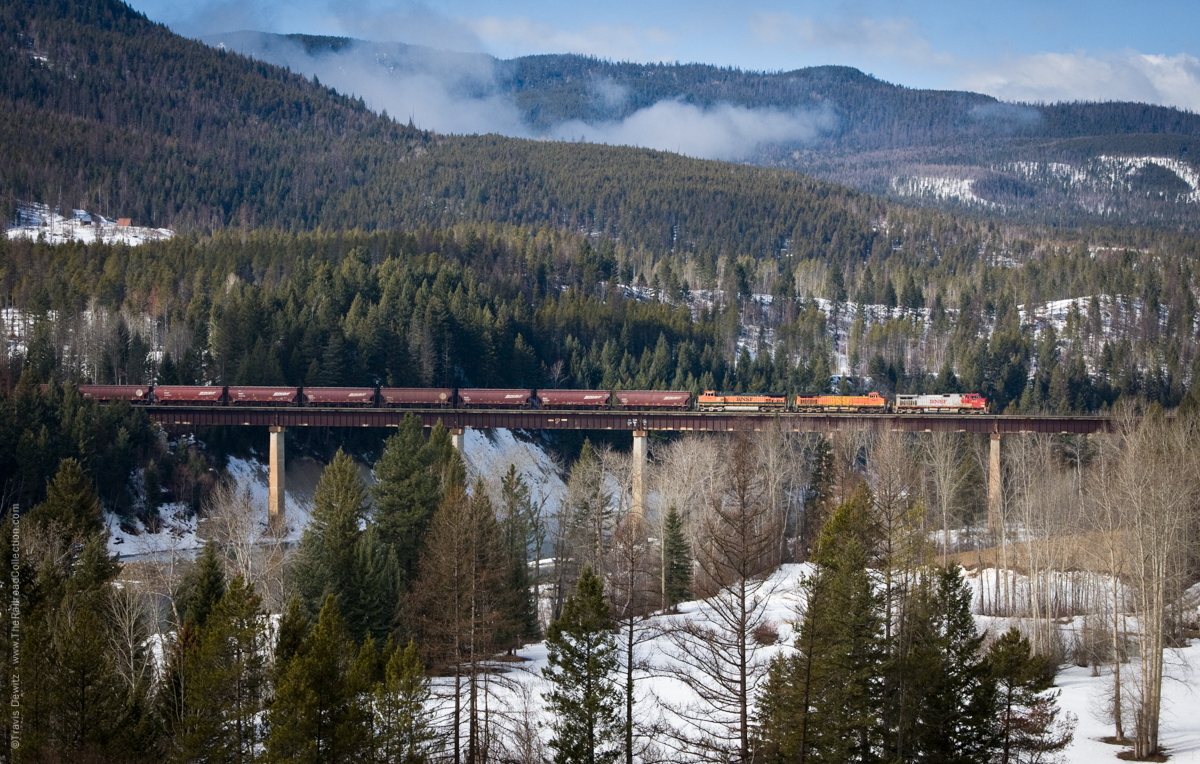
Essex — Vistas. Heading east on US-2 from the Inn, you will very shortly see some dark snow sheds covering the railroad up on the hillside. Most of these are somewhat difficult to photograph, so this is one of your better opportunities. Just beyond the first snow shed is a grand overlook of the Snow Creek Trestle. You’ll have to park and walk back to this spot (be careful), and it’s definitely a morning location. A tripod would be useful here, as you are shooting over a considerable distance, and you want to trip the shutter at the optimal moment.
Almost immediately past the view of the trestle is a sign to Goat Lick. Turn in here, park, and walk the 50′ or so to the observation platform. During June and July, especially, mountain goats come to the bottom of the cliff side to take advantage of the minerals available at the lick. Bring your binoculars and you’ll have a blast. The trestle is just to the northwest, and is in full view in the area.
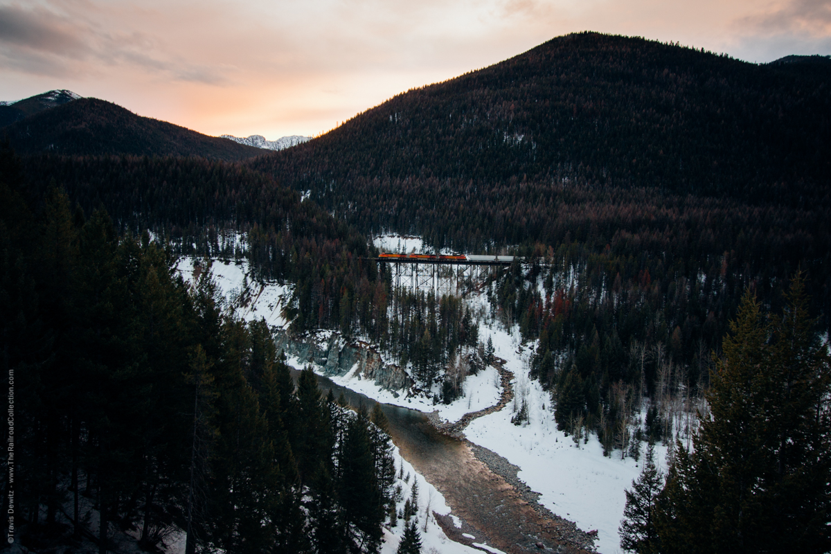
Sheep’s Creek Trestle – Essex, MT
Essex — Java East. Just east of Goat Lick, you’ll go under the tracks. This is the only railroad overpass on the entire tour. It is at this point that the northwest-southeast tour now becomes sharply southwest-northeast in orientation. About 100 yards before going under the underpass, you’ll see a clear but little-used dirt road to the right. Park and walk down the road to the tracks. On your right, coming from the west is the Java Creek Trestle. Lighting is a bit of a challenge here, but the trestle is a big deal, and you’ll want to get a few good pix. The afternoon is probably best for photos.
Walk back to your car, cross the road, and walk towards the overpass. Go up to the tracks on the east side of US-2. This is the Java East CPt, and is MP 1165.2. This is not much of a photo location, and you’re probably trespassing there, so I don’t recommend it as a railfan location.
Summit, MT
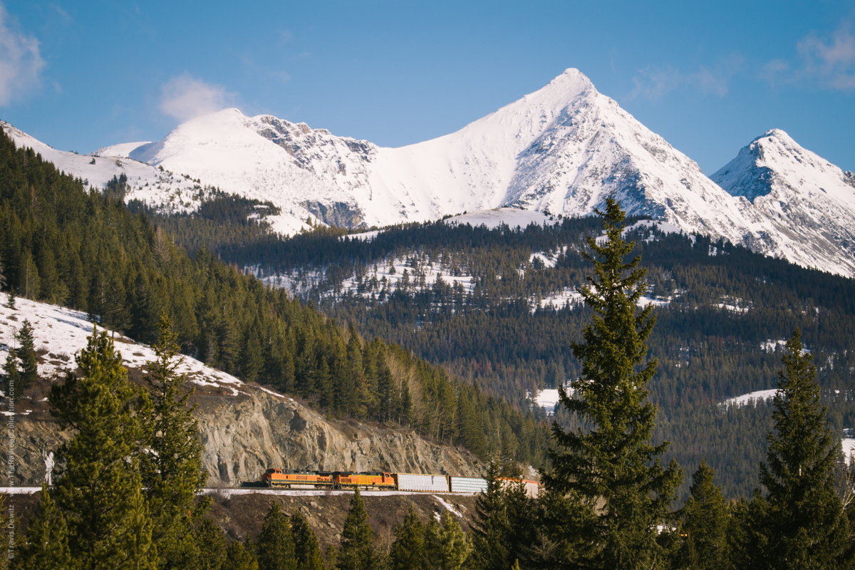
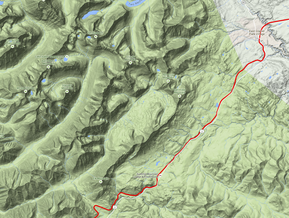
As mentioned above, you’re now at the bottom of the “V” shaped road between West Glacier and East Glacier. The road and railroad begin the long ascent to Marias Pass now. The railroad is on the opposite side of Bear Creek, rather far above the level of the road. Photos are somewhat difficult, as sunshine makes the trains within the snow sheds virtually invisible. Between Java East and the summit, you cannot get close to the trains, but you can see a long train snaking around the curves and bends as it works its way uphill. This is a great event for a video camera, but a still camera cannot capture the impressive work being done by the train as it works up the engineering marvel that James J. Hill put together. This really is an impressive site, perhaps best enjoyed while a colorful stack train does its work.
There is a major horseshoe curve at Blacktail (about 10 miles east of Java East), which goes inland a considerable ways perpendicular from the highway. I was lucky enough to see this site from the air in a Boeing 727 going from Kalispell to Minneapolis. At that point in the flight, you are still gaining altitude, so if you know where the curve is, it’s very obvious. Only from the air can you truly realize the impressive engineering which created this railroad’s ability to assault and conquer this hill. If you’re not sure where this location is, wait for a long stack train down by Java East, and pace it up the mountain for the next 10-15 miles. You’ll see it clearly snaking along the hillside — it’s really quite a show.
Marias Pass – Montana
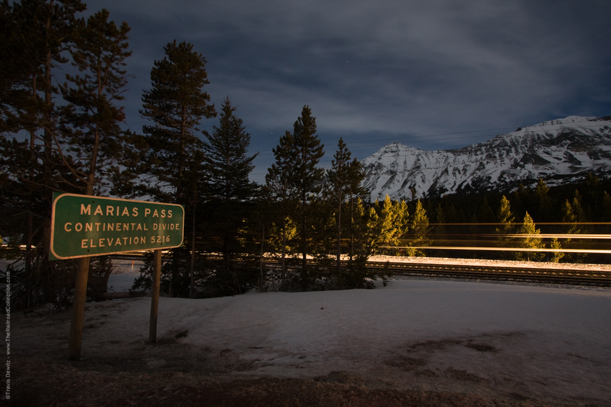
Marias Pass. US-2 takes you right up to the top of the pass, and to a truly outstanding railfan location. While not the most photogenic spot on the tour, this is, in my humble opinion, the best place on the entire tour to watch trains. This is raw power against the law of gravity, and is blood and guts railroading like it should be. To the east of the road are monuments to Teddy Roosevelt (an obelisk), Stevens (the engineer and surveyor who surveyed this route, and found Marias Pass, which is the lowest crossing of the Continental Divide in Montana. Stevens Pass of the Canadian Pacific is named for him, but I cannot remember his first name.), and other pioneers. There is a National Forest Service campground behind the parking and monument area.
In the area of the tracks themselves, you’re wide open on both sides of the two main tracks. You’ll have no need to trespass. Get out the lawn chairs, coolers, and relax and let the big dogs come to you. The summit is 5,216 feet above sea level, and trains in both directions work hard to get up there. The entire area is very windy — it’ll about knock you over at times — which adds to the interest in this location. You’re 1149.8 miles from Minneapolis on the Great Northern Railroad.
NOTE WELL: The wind really does blow hard up here, and the temperature is usually between cold and really, really cold. Make sure you have proper protective clothing before getting out of your car. Make sure your car has a good battery and excellent tires. In winter, you’ll need chains. Other than summer months, this is not a place to casually drop by. Be prepared for rough weather and road conditions.
Marias Pass
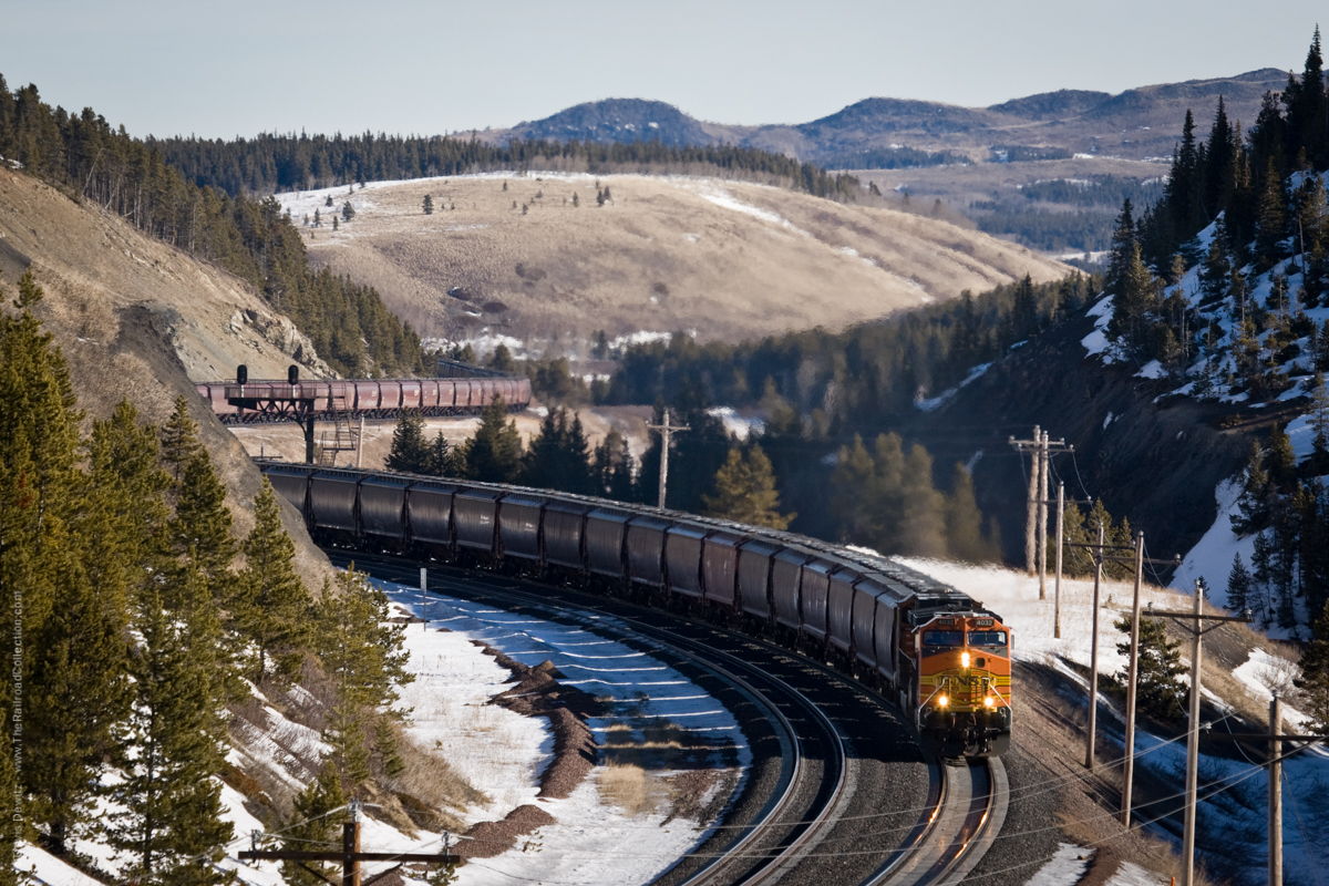
Marias Pass — East. This is a mid-day to early afternoon photo location, and it’s a terrific one. When you go over Marias Pass, you’ll see an immediate, dramatic change in the landscape. It’s still mountainous, but the trees are gone! The forested mountainsides have been replaced by mostly bare, sere vistas. About 1 mile from the summit, you’ll see the top of a signal bridge with 2 signal masts (but they’re easy to miss eastbound, so be on the lookout for them). You’ll then see a road leading up to the tracks. Park at US-2 and walk to the tracks. There is plenty of room well back from them. What makes this place so special is the broad, sweeping, unobstructed view to the northeast. For mid-morning to mid-afternoon, this is an outstanding place to shoot westbounds, and it’s not quite as blustery as the summit. There is a defect detector here.
All along this part of the downhill slope, from Marias Pass to Bison, there are numerous other photo ops of trains against the sere backdrop of the hillsides. The absence of the forests may be less beautiful than the scenery west of the pass, but the photography is sure easier.
East Glacier, MT
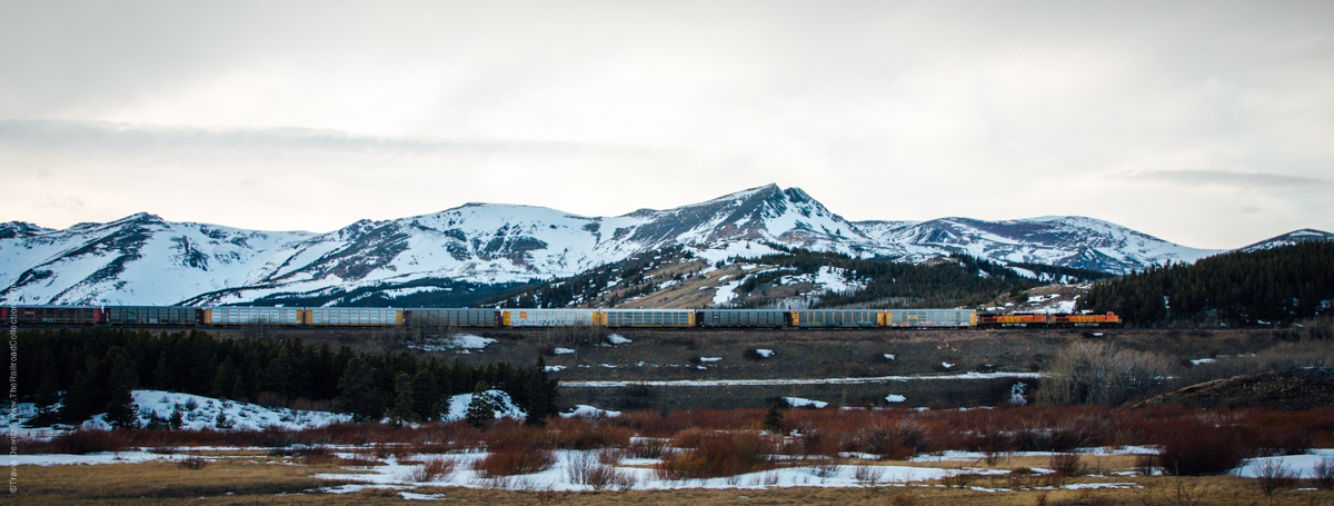
Bison — West. You’ll see another set of signals further east, and you can park and walk to the area of the tracks. This is the west end of the Bison siding, at MP 1145. To the east of the controlled point is a very nice, semi-down on shot thru a shallow cut. This would be good for late morning and most of the afternoon for westbounds. Eastbounds would be good most of the morning.
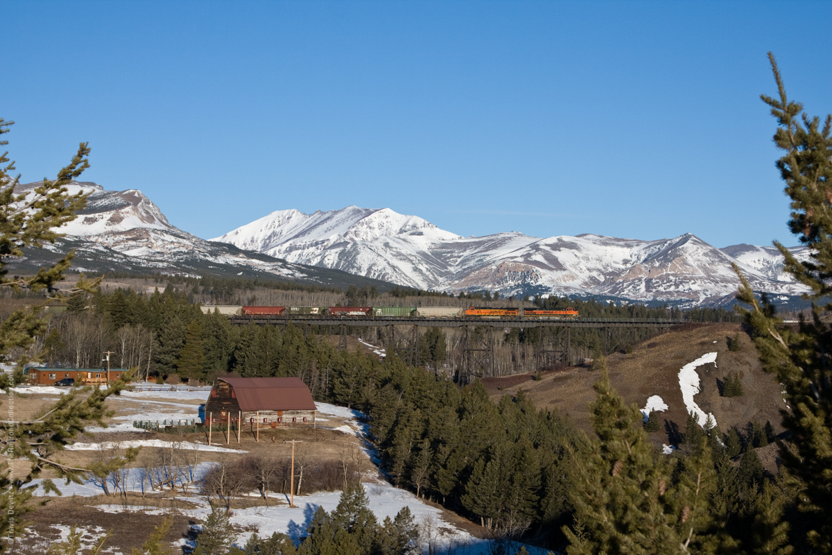
Two Medicine Bridge – East Glacier, MT
East Glacier — Midvale Trestle. Coming into the village of East Glacier, the train crosses Midvale Creek on a moderate trestle. As of August 2001, US-2 was torn up, while the road’s bridge over the creek was being replaced (obviously James Hill’s construction standards were vastly superior to recent road construction standards.). When this work is finished, shots of trains on the trestle should once again be decent. If you’re staying at the lodge across from the station, this spot is a short walk for you.
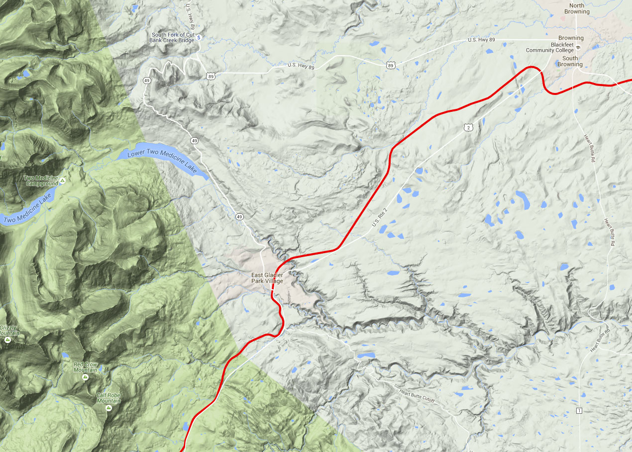
East Glacier — Station Area. Immediately prior to reaching the station, MT-49 goes north from US-2. It ducks under the railroad thru a nicely painted underpass, and on to St. Mary and the eastern entrance to Glacier National Park (see the Suggested Itinerary for a description of MT-49). To park at the station, take MT-49 under the tracks, and then take your first right to get up to the station.
BNSF Marias Pass – Click to Enlarge
BNSF Marias Pass – Click to Enlarge
The building is in the Great Northern “big timber and solid construction” motif, and just seems to be a part of the landscape. Speaking of landscapes, someone at the station has developed a lovely garden of flowers, and these bloom beautifully in mid-August, long after they’re long gone from gardens in more southern parts of the country. They’re a treat. The station serves as an Amtrak stop from May to September. There is good viewing from the north, but only fair from the south, as it’s somewhat tight.
This is a logical place to end this tour of the BNSF thru the Glacier Park area. I hope you’ll enjoy the area as much as I did. If you’d like to extend the tour either to the east or from the west, contact me at tohill@hotmail.com . Additional tour segments can be anywhere between Seattle and Minneapolis. Submitted by Frograil.
Comment (1)