No. 3096 – Montana Rail Link – Paradise, Mont.
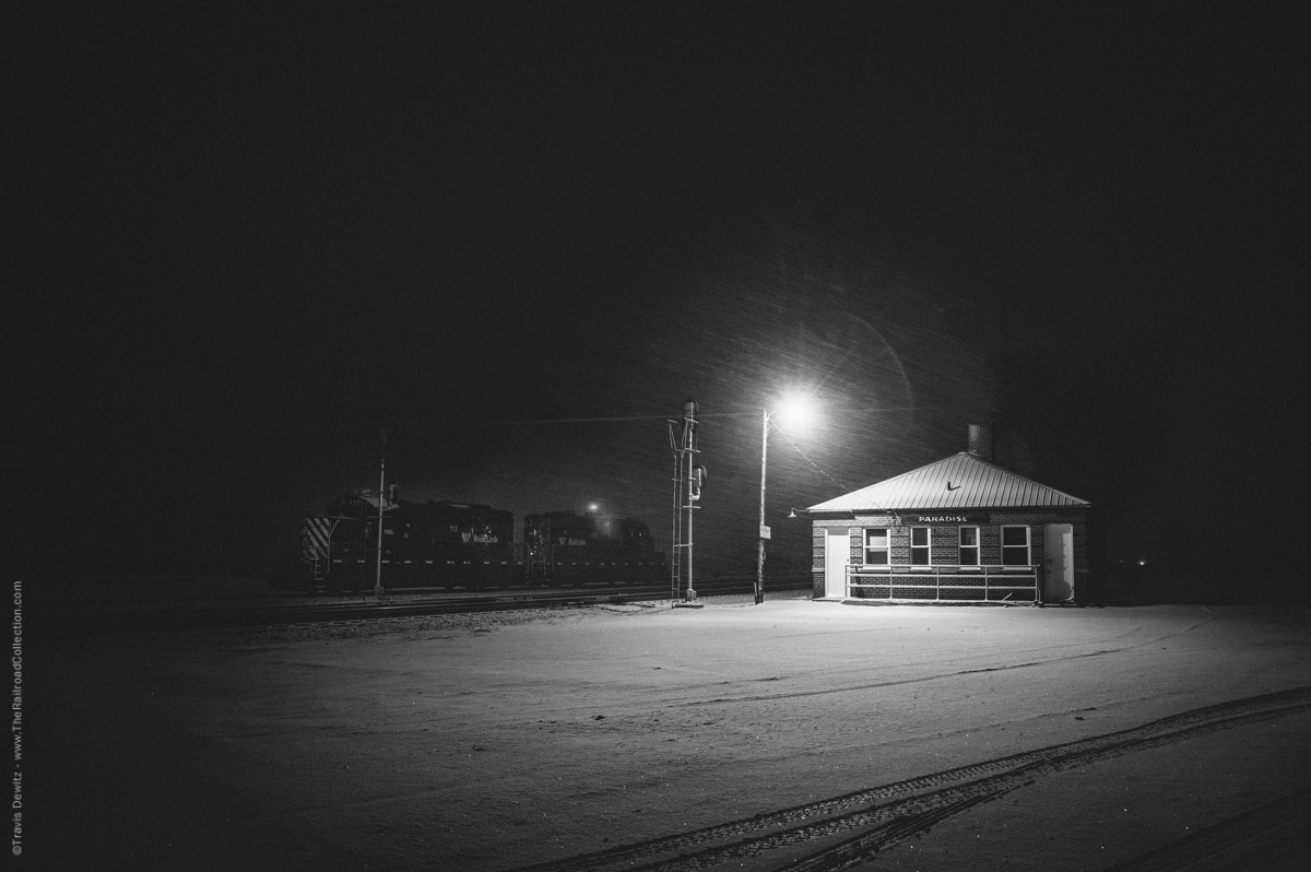
A place where it all comes together, Paradise, Montana. It is March, 2015, a strong wind whips the falling snow throughout western Montana including in Paradise. Two Montana Rail Link geeps sit in the yard next to the old depot. These locomotives are used for the Paradise local that serves the area.
Paradise, Mont.
The tracks were first laid here in 1883 by the Northern Pacific Railway. That same year, Paradise was born. Many argue that the name originally was “Pair o’ Dice” but not by the railroads accounts. This was NP’s division point and also where crews would set their watches forward or back to compensate for the time zone change (Mountain-Pacific) on their mainline to the west coast.
The Northern Pacific Railway also operated a tie treating plant here where timber ties were creosoted. The plant was destroyed by fire.
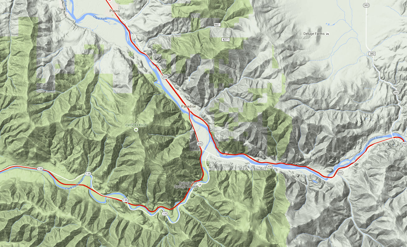
Paradise is wedged between the Coeur d’Alene Range to the south and Cabinet Range to the north along with the Clark Fork. The second highest peak of the Coeur d’Alene Range towers over Paradise, Patricks Knob(6,837 feet). Just to the east is where the Flathead River meets the Clark Fork. At this junction, the Reservation Divide comes to a point with the other two ranges creating tri-point. These three ranges protect the 2,500 foot lower valley of the Clark Fork River, which has mild winter weather comparable to the Pacific maritime. Plains, MT just west of Paradise was once called Wild Horse Plains. Native American use to winter there horses there.
It followed along what was once an Indian Trail and later a wagon trail up Evaro Hill to the Clark Fork.
Evaro Hill
Paradise is also where the MRL’s 10th Subdivisions meets the 4th Subdivision. The 10th Sub was Northern Pacific’s original route west from Missoula. It followed along what was once an Indian Trail and later a wagon trail up Evaro Hill to the Clark Fork. The grade up Evaro hill is 2.2% in both directions which made for a tough climb. In 1909, NP finished the low line that ran along the Clark Fork. The low line or river line is 20 miles longer and is the route mainly used west from Missoula. The line up Evaro became known as NP Passenger Line and today is used by MRL’s gas local and some empties.
So as you can see, Paradise is where two rivers, three mountain ranges, and two rail lines all come together. With the great mountain scenery, this place really is Paradise.
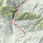
Click to see full map showing Montana Rail Link’s 4th and 10th Subs west from Missoula.

About the Photographer
Travis Dewitz is a professional photographer located out of Eau Claire, Wisconsin. He has been published in many books and magazines including many in the railroad industry. He does a lot of photography work and environmental portraitures for many companies and heavy industries in and around Wisconsin. He has grown up with trains and railroads are one of his passions that he pursues. His railroad photography can be seen on his website The Railroad Collection.
Like and Share with your friends and family!
Larry Pinkley
When I was young I worked the Paradise switcher and the run to Trout Creek. I had to stay at the N.P. lodging, which was just a two store house or building with showers and toilets in the basement. If I recall the rooms where $1.75 and towels were $2.00. The beanery was just across from the depot, across the parking lot in fact on the same side of the streel, a white building. The MRL used it for storage. The food was good and cheap, subsidized by the N.P. The beanery sold five books, which were a book of coupons worth a nickel each, that totaled twenty dollars. All you did was stamp with your payroll stamp for a five book, ( you were allowed one five book a day ),and sell them right back to the beanery for cash. There was a large water tower just east of the beanery. The V.F.W. was always where it is now basically. A store was on the end of main street. There was a bar down the road toward Plains called the green shingles, it burned down. I heard that the ground of the tie plant caught on fire and burned for two weeks. I don’t remember working the plant, but I did because I worked the Paradise Switcher. The drinking and the card games that went on in the restroom was unbelievable, the money that changed hands and the boos. Always on the night shift were the card games. I’ll never understand how I didn’t turn into an alcoholic. I had the money, the friends that would drink their brains out and the time, it was all there. Most rails didn’t become alcoholics, I never made it either. I have a picture of Paradise you might be interested in, I’ll send you, it’s an old picture, even yellowed. Pack River owned almost all the lumber mills between Paradise and Sand Point Idaho. They had the money in those days.
Jim Ray
Well Hells Bells Larry, I thought you Lived there in Paradise!
I saw my first live, in the wild, big horn sheep and mountain goat there just outside of town.
Loved the history lesson, thanks for sharing.